Fort William Henry – Recreating an 18th Century Fort with Animation
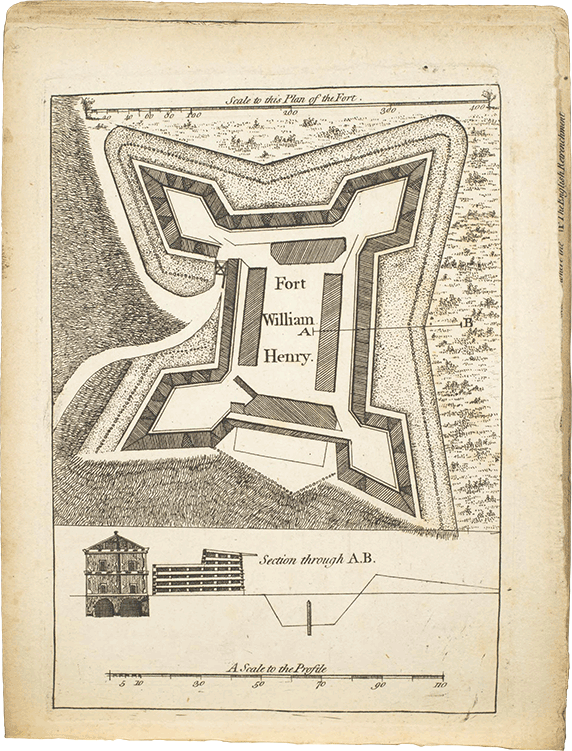
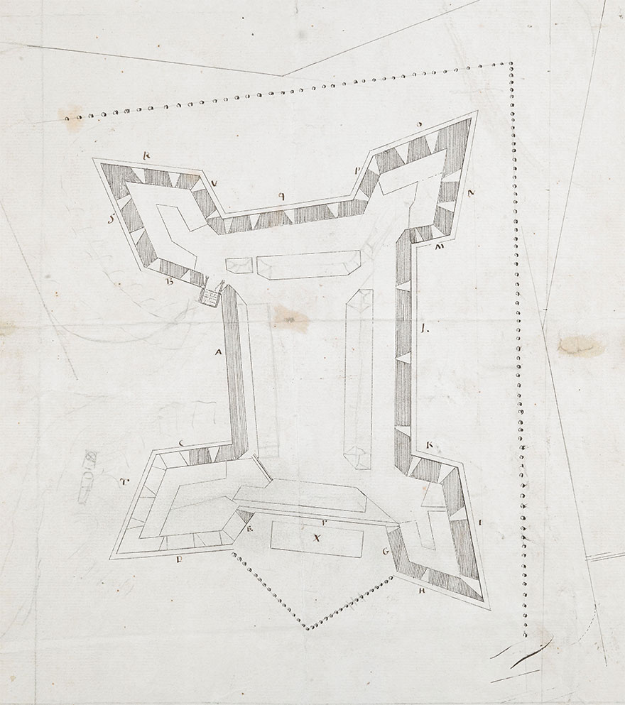
Fortunately many plans, maps, and other documents related to the fort have survived through the years. These historical archives have been a wonderful resource in recreating both the fort and the story of the siege.
Consensus among the Historical Documents
The many maps related to Fort William Henry all agree on the general shape of the fort and its outer walls. Several plans even have measurements for the length and width of the walls. This information was extremely helpful when building the animated version of the fort.
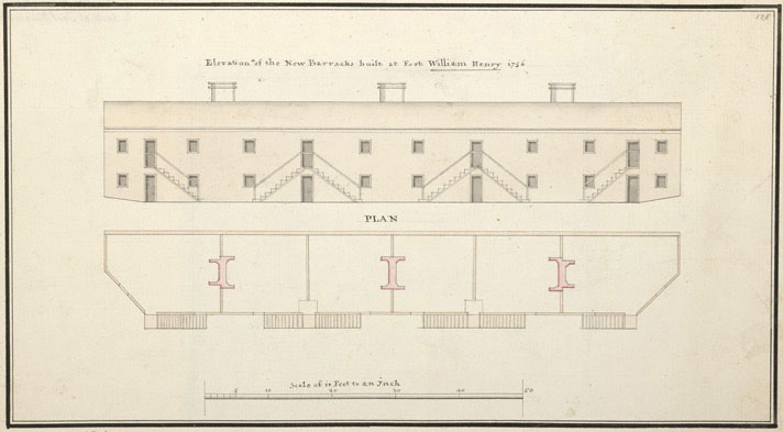
I was also able to find plans for two of the barracks and a magazine on the back of the Northeast curtain, which I used as a basis for the buildings.
Whether or not the fort was actually built exactly to these specifications we can never really know, but at least we know what they planned to do.
Disagreement among the Historical Documents
While the historical documents agree on the shape and size of the walls, they don’t all agree on the buildings inside the fort.
Most maps indicate four buildings, but I have seen several that show more. I also saw an engraving on a powder horn from 1756 that showed only one building inside the fort.
To make matters worse, military reports and journal entries from the time period further confuse the location and number of buildings.
Fort William Henry Was Constantly Under Construction
As I have dug deeper into the story of Fort William Henry, I have learned that the Fort and its environs were constantly being overhauled as the French and Indian War went on.
Fort William Henry was First Built in 1755
In November of 1755 when the fort was built, William Johnson (the commanding officer) wrote “Two Ranges of Barracks built, but we are distressed for boards to floor them… The Timber is getting for another Barrack.”
In 1756 a new building Needed to be Constructed
The following year, a different commander of the fort complained that his men needed to complete a building that should have been finished the previous year. Perhaps this was the barracks that William Johnson wrote about, or maybe a completely separate building. The documents are not clear.
The Fort was Inspected in August of 1756
Also in 1756, 3 officers sent to inspect the fort, recommended several modifications to Fort William Henry. Two of their recommendations were to build barracks along the West curtain, and a magazine parallel to the North curtain..
I found a plan for a magazine “on the back of the Northeast curtain,” which I used to build the 3D version of the fort, but can’t be certain if, or when this exact magazine might have actually been constructed.
The Final Build of the Animated 18th Century Fort
Looking through written accounts and period maps, it seems that the fort was constantly under construction and being modified through its brief existence. My documentary does cover the entire life of the fort, but primarily deals with the siege in 1757. Because of this, I opted to build the animated fort as it most likely looked at that time.
There is no way to know for certain every detail of an event from 1757, but the majority of maps and documents from the time period all suggest the same thing. A fort with an irregular square shape, having bastions at the four corners, and four buildings inside. One of them used as a magazine, and another a hospital.
Armed with this information I built the 3D animated version of the fort that can be seen in the video above.
The Full Documentary about the Siege of Fort William Henry
The video at the beginning of this post is an excerpt from a full length documentary, which is available now on DVD!